As the OHAHP team began planning the 2019 field season, I was most anxious about remote camping on Sitkalidak Island. I had done some camping before, but only in established campgrounds in national parks where there were latrines, water pumps and road access. Sitkalidak is far more isolated. No human communities reside there on a permanent or semi-permanent basis, but it is home to the renowned Kodiak brown bears and, since the past year, a herd of bison that is owned by the Old Harbor Native Corporation. I had no clear vision of how we would sustain a safe and functioning camp.
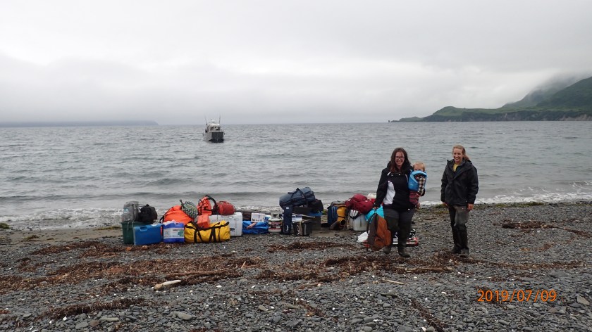
Erin, Wyatt and Hollis standing on the beach at Tanginak with all of our camp gear. The boat in the background (piloted by Geoff Bechtol) had just dropped us off! (PC: Ben Fitzhugh)
Thankfully, Ben has numerous years of experience setting up and running remote camps, so he led Erin, Wyatt and I in making Tanginak our home for 3 weeks.
Our personal tents set up at Tanginak.
In order to minimize food smells (which could attract bears or other wildlife) near our sleeping areas, we set up our personal tents at a distance from the cooking/eating tent. We also washed dishes at a third separate location and stored bear-attractant foods in a sealed container in a spring. That spring was also our source of fresh water, which we filtered using a hand-pumped spigot. The spring has been running for thousands of years and is likely where Alutiiq ancestors living at Tanginak got their water as well! One of the things I love about archaeology is how it makes plain that landscapes and places connect us through time, even as we write new meanings onto them – the Tanginak spring is but one example.
The Tanginak Spring flowed out from under the knoll where we camped. Our water pump is in the foreground.
It is a lot of work to run a remote camp – keeping things clean, sharing cooking tasks, pumping and carrying water, etc. – especially with just three adults. The close social quarters also created some moments of tension. Despite the challenges, however, it is hard to beat living in such a beautiful place and I am eager to return to Tanginak next summer – hopefully with a larger field team, including students and community members from Old Harbor!
Feel free to comment or reach out on social media if you have any questions about living at Tanginak or about the OHAHP. I would also love to hear your camping stories and tips!
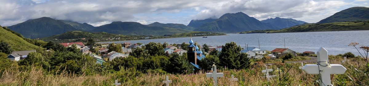
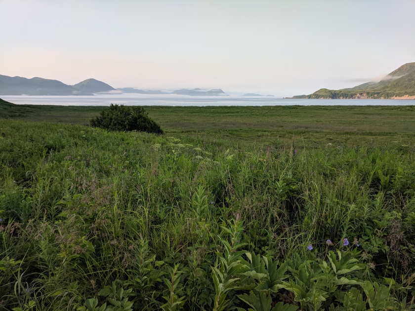
View of Tanginak Anchorage, where Ing’yug is located, from our campsite.
It has been an amazing field season on Kodiak! I had the pleasure of participating in two different projects – the OHAHP and a joint Alutiiq Museum/Koniag Inc. project at Karluk Lake – and now feel like a bona fide Kodiak archaeologist.
Following the project at Karluk Lake in June (which you can read about here), the rest of the Seattle-based field team arrived and we travelled to Old Harbor to initiate excavation at KOD-114, an ancestral village on Sitkalidak Island. In the Alutiiq language, this village is called Ing’yug, while Russian colonists and explorers called it Ezopkinskoe. Ing’yug was inhabited by Sugpiaq/Alutiiq ancestors when the Russian fur trader Grigorii Shelikhov arrived in the Kodiak Archipelago in 1784. Subsequent ethnohistoric documentation comes from Russian explorer Yuri Lisiankski, who visited the village in 1805. While a broad written history of Russian colonialism on Kodiak exists, those accounts are often written from the perspective of the colonizer and lack the details of daily life in Sugpiaq/Alutiiq villages during this period of culture contact, resistance, persistence and change. That’s where the archaeology comes in! By studying the materials (i.e. houses, tools, food remains, toys, trash, etc.) that Sugpiaq/Alutiiq ancestors left behind, archaeologists can get a complementary, and perhaps fuller, picture of how those ancestors lived through this period of history.
With that in mind, our 2019 OHAHP team set several goals at the start of the field season for our work at Ing’yug:
locate houses and middens (trash piles)
map the extent of the village site
collect some artifacts and fauna (animal remains) for analysis
determine dates of occupation for the village
Erin Gamble lays out a test pit inside a house at Ing’yug.
Overall, these goals were met. (More posts to come about each of the activities mentioned below!)
We dug a total of 15 test pits and one trench in order to identify houses with intact stratigraphy and look for diagnostic artifacts that could confirm the age of the site.
We made drawings of the stratigraphy in several of our test pits to better understand what activities may have led to those strata being deposited over time.
We made a map of the houses and other structures visible on the surface using a compass, a couple 50-meter tapes and a low-tech surveyor’s tool called a transit.
Hollis setting up the transit for mapping at Ing’yug. (PC: Ben Fitzhugh)
While the stratigraphy (i.e. layers in the soil, both naturally and culturally formed) was largely intact where we dug, we also noticed evidence of pot-hunting across the site. Pot-hunting is destructive to archaeological sites, not only because cultural material is lost, but because information about the location and context of artifacts in relation to other objects, houses and the site overall, are also lost. It’s like losing pieces to a jigsaw puzzle – a jigsaw puzzle that is already missing pieces due to natural processes like erosion and decomposition that occur over time – making it harder to see the whole picture.
Ben taking notes and making drawings of a test pit. It is important to document what we find in archaeological sites, so that knowledge isn’t lost after the ground is disturbed.
We found an abundance of evidence of Sugpiaq/Alutiiq residence at the village of Ing’yug in the form of charcoal-rich layers in the soil, shells and animal bones left over from meals, and a literal ton of fire cracked rocks. What we didn’t find were many artifacts, which surprised us given the extent of the trash piles, or middens. I’ll discuss this more in another post.
Sam Hordeski excavates around a whale bone in a test pit at Ing’yug.
The dearth of artifacts means that estimating dates for the site was impossible in the field, however, we did collect wood charcoal samples, which can be dated using radiocarbon, and shells from the midden, which have growth rings like trees that make it possible to use them for dating. Hopefully these or other dating methods can provide some clarity of timing, so that we can place Ing’yug within the wider story of Sugpiaq/Alutiiq ancestors across the Kodiak Archipelago and beyond.
Stay tuned for more posts about the archaeology of Ing’yug, camping on Sitkalidak and visiting Awa’uq, a refuge rock that Shelikhov attacked when he arrived on Kodiak in 1784.