As the OHAHP team began planning the 2019 field season, I was most anxious about remote camping on Sitkalidak Island. I had done some camping before, but only in established campgrounds in national parks where there were latrines, water pumps and road access. Sitkalidak is far more isolated. No human communities reside there on a permanent or semi-permanent basis, but it is home to the renowned Kodiak brown bears and, since the past year, a herd of bison that is owned by the Old Harbor Native Corporation. I had no clear vision of how we would sustain a safe and functioning camp.
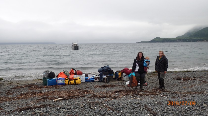
Erin, Wyatt and Hollis standing on the beach at Tanginak with all of our camp gear. The boat in the background (piloted by Geoff Bechtol) had just dropped us off! (PC: Ben Fitzhugh)
Thankfully, Ben has numerous years of experience setting up and running remote camps, so he led Erin, Wyatt and I in making Tanginak our home for 3 weeks.
Our personal tents set up at Tanginak.
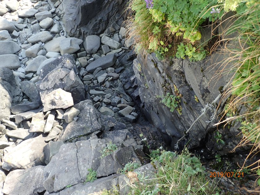
In order to minimize food smells (which could attract bears or other wildlife) near our sleeping areas, we set up our personal tents at a distance from the cooking/eating tent. We also washed dishes at a third separate location and stored bear-attractant foods in a sealed container in a spring. That spring was also our source of fresh water, which we filtered using a hand-pumped spigot. The spring has been running for thousands of years and is likely where Alutiiq ancestors living at Tanginak got their water as well! One of the things I love about archaeology is how it makes plain that landscapes and places connect us through time, even as we write new meanings onto them – the Tanginak spring is but one example.
The Tanginak Spring flowed out from under the knoll where we camped. Our water pump is in the foreground.
It is a lot of work to run a remote camp – keeping things clean, sharing cooking tasks, pumping and carrying water, etc. – especially with just three adults. The close social quarters also created some moments of tension. Despite the challenges, however, it is hard to beat living in such a beautiful place and I am eager to return to Tanginak next summer – hopefully with a larger field team, including students and community members from Old Harbor!
Feel free to comment or reach out on social media if you have any questions about living at Tanginak or about the OHAHP. I would also love to hear your camping stories and tips!
One Sunday during our stay at Tanginak, we took a hike down the beach of Fox Lagoon to visit Awa’uq, about five miles from our camp. Awa’uq is a refuge rock off the Pacific coast of Sitkalidak that is the site of a massacre of Alutiiq people by the Russian fur trader Gregorii Shelikhov in 1784. In the Alutiiq language Awa’uq means ‘to become numb’, so named after the massacre that left hundreds of Alutiiq people dead while the Russian force suffered no casualties. This event marked the beginning of the Russian occupation of Kodiak and enabled Shelikhov to leverage control over Alutiiq leaders by taking survivors as hostages.
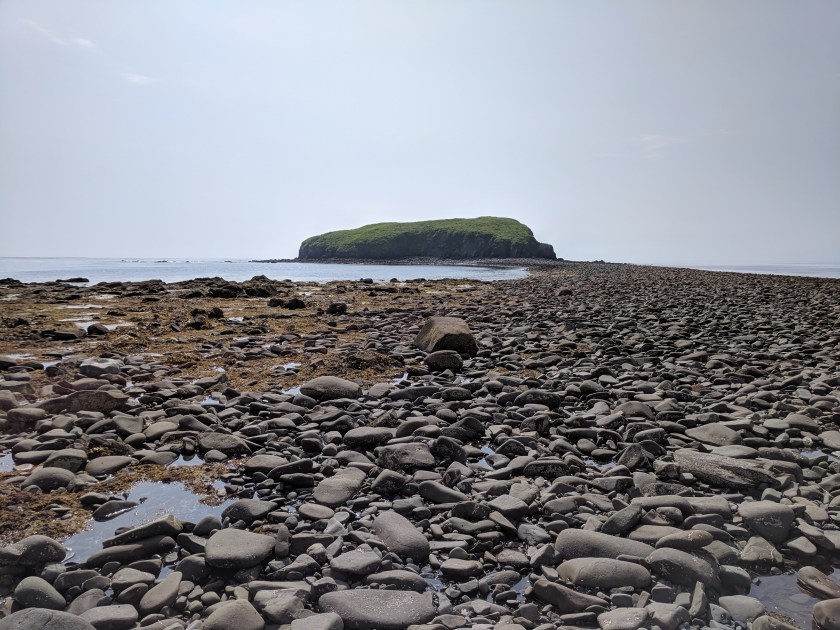
View of Awa’uq and the connecting rocky spit from the shore.
Refuge rocks were important landmarks in the Alutiiq past – safe places with temporary settlements for people to hide during raids, which were common across the Gulf of Alaska prior to European colonialism. The geography and geology of refuge rocks – steep cliffs, limited access, low visibility of settlements from the water – made them difficult to attack. In the case of Awa’uq, the sea-facing side of the rock is very steep and the rock is only connected to the mainland by a rocky spit at low tide.
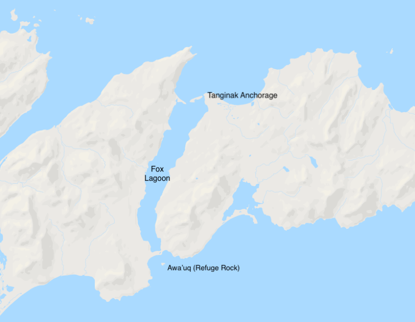
Map showing the location of Awa’uq in reference to Tanginak Anchorage (base map from Google). They are about 5 miles apart.
Getting to see Awa’uq in person was breathtaking. I could feel the weight of what had happened and better imagine the retreat to refuge. During our visit this summer, we walked to Awa’uq, but Alutiiq ancestors from the village of Ing’yug would have travelled by boat – making the toting of provisions and children quicker and easier than our own journey. I imagined families hurrying across the connecting spit at low tide, climbing up to the top of the rock by a (now) rotted rope, and monitoring the sea from the great vantage. I also saw the ridge across the spit where Shelikhov placed his cannons and how exposed the rock was from that angle.
Rope that was used to climb on top of the rock during the 1990s excavations. The rope is now mostly rotted, but we still climbed up at the same spot. (PC: Ben Fitzhugh)
When we got to the top of the rock it was too overgrown to really see much, but I could sense the topography of house pits crammed together under a thick blanket of pushki, nettle, salmonberry and fern. A house on Awa’uq was excavated by archaeologists in the 1990s, but we didn’t spend long looking for it as we were wary of the rising tide and our narrowing window to cross back to the beach. I can imagine that it is as easy to feel trapped on this rock as it is to feel safe, perhaps something that Alutiiq ancestors pondered as they were awakened by the booms of cannon fire that August morning in 1784.
I was struck most by the views from Awa’uq – both looking out on the vast ocean and back at shore where vertical rock strata outcropped and were eroded in beautiful curving lines. The place somehow felt different than anywhere else on the island that I’d been, with both the elegance and devastation of geologic and human history so boldly on display. It’s a sight that’s difficult to forget.
View to the east from the top of Awa’uq. (PC: Ben Fitzhugh)
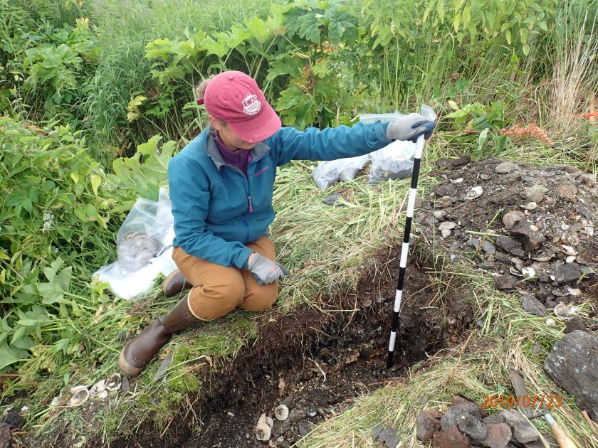
Hollis measuring the depth of a test unit. (PC: Ben Fitzhugh)
As I mentioned in other posts about OHAHP’s 2019 field season, we found very few artifacts while digging test pits at Ing’yug on Sitkalidak Island. This surprised the team, because the village was occupied recently and the houses were relatively well-defined on the surface, indicating little post-occupation disturbance. So, why didn’t we find many artifacts and what could that mean about life in the village of Ing’yug?
We know that Sugpiaq/Alutiiq ancestors at Ing’yug were affected by the arrival of Russian fur trader Gregorii Shelikhov in 1784, as he laid siege to Awa’uq (refuge rock on the Pacific side of Sitkalidak Island), took hostages and conscripted Native men into hunting parties. Those left in the village of Ing’yug would have been primarily women and children, whose first thoughts were likely about survival and getting enough to eat. As of yet, we don’t know how many people lived at Ing’yug either before or after Shelikhov’s arrival, but I can imagine that the population loss sustained at initial contact would have made it difficult for residents to meet all of their subsistence needs. In such a traumatic situation, ancestors at Ing’yug likely expended all their energy on collecting foods that were easily accessible nearby, while crafts and tool making became secondary – leading to fewer preservable artifacts in the archaeological record.
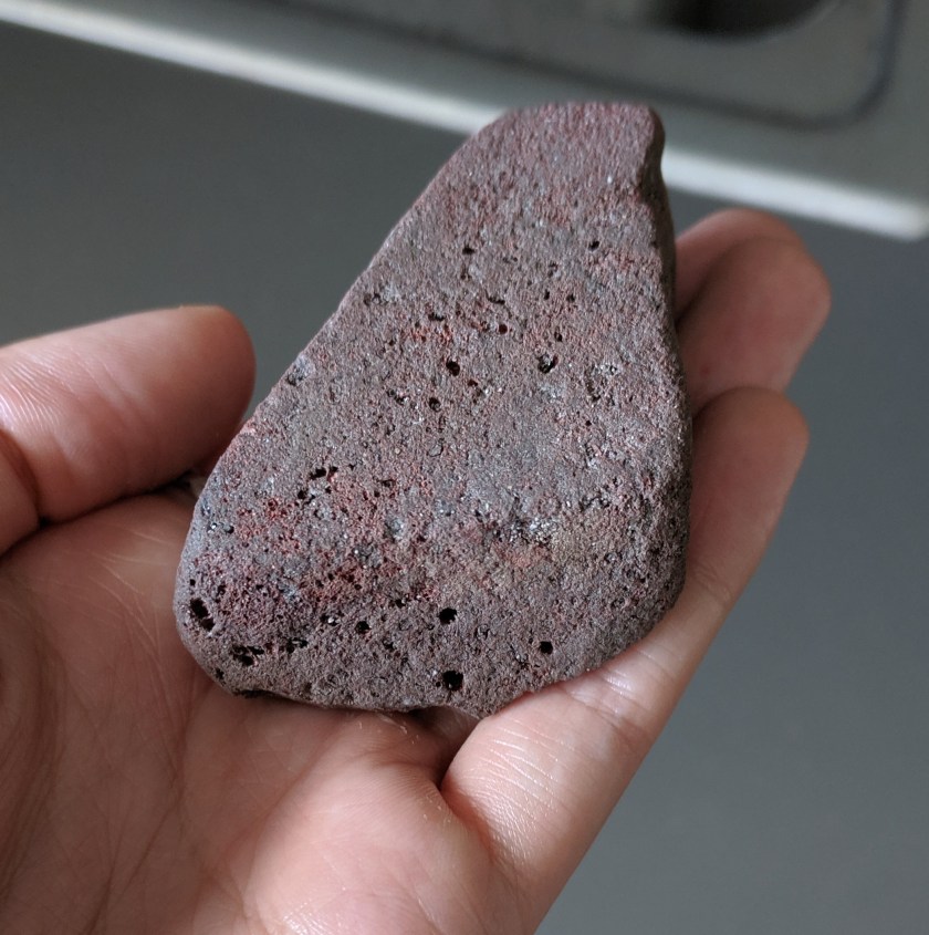
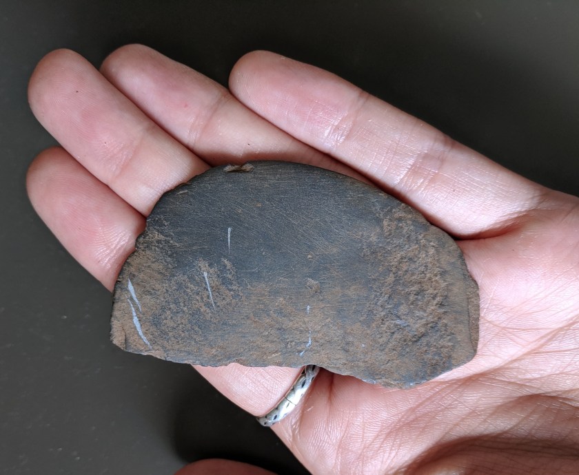
A pumice abrader found at Ing’yug in 2019. Abraders were used to smooth and refine stone tools.
Another possibility is that when the village was abandoned, people took their tools and belongings with them, leaving little behind for future archaeologists to uncover. While this practice is likely, it would not totally explain the dearth of artifacts, because we did not even find many broken tools or flakes (and no glass trade beads). These items would have been left behind or were easily lost on the floors and in the corners of houses, but even they were largely absent.
Other possible explanations have to do with events that happened since the village was abandoned. Notably, we noticed that some areas of the site, especially a large house behind the main beach berm, had evidence of pot-hunting. Pot-hunting (also sometimes called looting or subsistence digging, depending on the context) includes any intentional digging in an archaeological site that is done without a permit or proper documentation of the ground disturbance and findings. At Ing’yug we found numerous pits that had been dug by pot-hunters, which made it difficult for our team to place test pits in undisturbed locations.
A small ulu found at Ing’yug in 2019. Ulus are traditionally made and used by women. They were produced in various sizes to accommodate many cutting and scraping tasks associated with hide preparation and food processing (especially of salmon!).
Another post-depositional event that could have affected the placement and preservation of artifacts in the village is a tsunami, like the one that hit Kodiak in 1964. The 1964 earthquake and tsunami severely damaged or destroyed several Alutiiq villages on Kodiak, including Kaguyak, Old Harbor and Afognak. The beach berm that supports Ing’yug has a swale cut through it, which may have been caused by the 1964 tsunami. The tsunami could have done some other damage to the site or displaced artifacts. That being said, the OHAHP team doubts that a tsunami disturbed the site badly, because the stratigraphy of the site is largely intact, including a thin layer of volcanic ash that was deposited by the 1912 Katmai eruption.
It is also possible that we simply missed most artifacts when digging our test pits! What other explanations can you imagine?
A stone pestle found in a midden at Ing’yug in 2019.
Now, I don’t want to leave you with the impression that our team uncovered nothing of value in our 2019 field season. We gathered great data from middens about diet, mapped and documented house structures and the stratigraphy of test units, and found a handful of stone artifacts (mostly on the last day of excavation). Excavating a house structure in its entirety will certainly provide even more information that we missed by only digging scattered test pits. I know there is so much more that Ing’yug has to tell us about Sugpiaq/Alutiiq ancestors during this tumultuous period of their history. We just need to be patient and listen.
Erin Gamble holding sea mammal vertebral bones found in a midden at Ing’yug.
During our excavations at Ing’yug this summer, we frequently encountered animal bones and shells. These bones and shells are often piled together with other household refuse in what archaeologists call a midden or trash dump. Middens are usually located near houses (as people did not want to walk far to throw away their trash) and offer archaeologists a view into what people in a particular house were eating and discarding in the past.
[Side note: Studying trash is such an effective way to learn about people’s lives, that there is a whole field called garbology that examines modern day trash to learn about behavior and social identities!]
The middens at Ing’yug are rich and well preserved, including whole bones and shells.
In the case of Ing’yug, a Sugpiaq/Alutiiq village site on Sitkalidak Island, the middens we found are composed of mussel, clam, scallop and urchin shells, sea mammal, fish and bird bone, and LOTS of fire-cracked rock. Hot rocks were used for cooking, smoking fish and steam bathing, but the rocks crack and are less able to hold heat after a while – meaning that they have to be replaced. The broken rocks are tossed into the midden along with the remains of animals that were eaten and/or used for skins. Often, archaeologists also find broken tools or other discarded artifacts in the midden, however, our limited excavations this summer revealed few artifacts among the animal remains and fire-cracked rocks.
OHAHP’s meter-deep midden trench at Ing’yug. (PC: Ben Fitzhugh)
The 2019 OHAHP team spent a couple days excavating a trench into a huge midden mound in front of a housepit at Ing’yug. This midden was very well-preserved and contained whole shells and bones amidst large fire-cracked rocks, demonstrating that Sugpiaq ancestors were eating many varieties of shellfish, seal, various fish, sea birds and even humpback whale! While we did not uncover whale bones in the midden, we found some barnacles from genus Coronula, which only grow on humpback whales. It is likely that whales were butchered where they beached and then meat was brought into Sugpiaq villages.
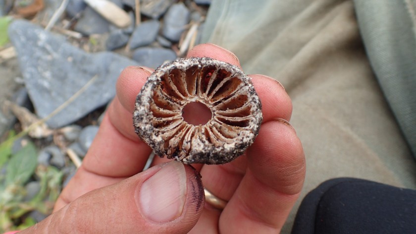
Coronula diadema, aka a humpback whale barnacle, found in a midden at Ing’yug. (PC: Ben Fitzhugh)
I hope that data from the middens at Ing’yug will be able to tell us not only what people were eating in a given moment, but also how diet changed over time. For instance, do we see a shift in diet following the Russian invasion of Kodiak? With substantial pressure placed on villages to provide tribute to the Russian American Company, Sugpiaq communities had less time to provision themselves – could that result in eating more easily accessible foods, like plants and shellfish, rather than foods that required traveling, like sea mammals? Analysis of dated midden deposits will help the OHAHP team answer that and other questions!
Feel free to reach out to Hollis on Facebook or Twitter (links to the right under “Follow”) if you have questions or comments!
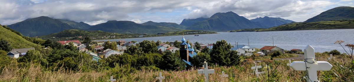
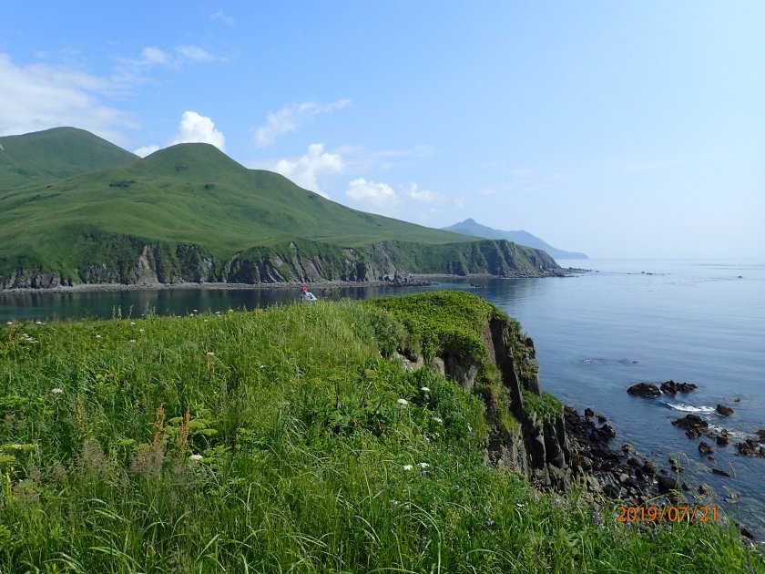
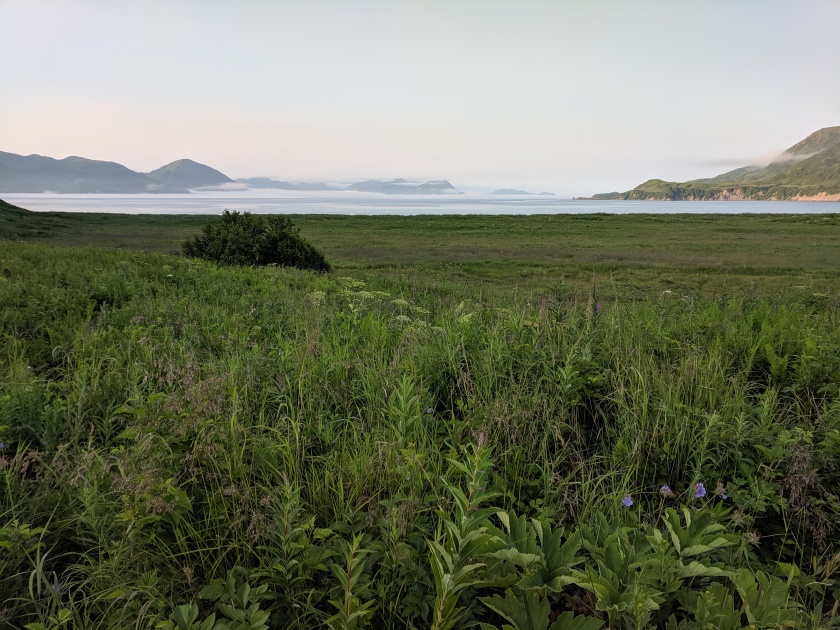
View of Tanginak Anchorage, where Ing’yug is located, from our campsite.
It has been an amazing field season on Kodiak! I had the pleasure of participating in two different projects – the OHAHP and a joint Alutiiq Museum/Koniag Inc. project at Karluk Lake – and now feel like a bona fide Kodiak archaeologist.
Following the project at Karluk Lake in June (which you can read about here), the rest of the Seattle-based field team arrived and we travelled to Old Harbor to initiate excavation at KOD-114, an ancestral village on Sitkalidak Island. In the Alutiiq language, this village is called Ing’yug, while Russian colonists and explorers called it Ezopkinskoe. Ing’yug was inhabited by Sugpiaq/Alutiiq ancestors when the Russian fur trader Grigorii Shelikhov arrived in the Kodiak Archipelago in 1784. Subsequent ethnohistoric documentation comes from Russian explorer Yuri Lisiankski, who visited the village in 1805. While a broad written history of Russian colonialism on Kodiak exists, those accounts are often written from the perspective of the colonizer and lack the details of daily life in Sugpiaq/Alutiiq villages during this period of culture contact, resistance, persistence and change. That’s where the archaeology comes in! By studying the materials (i.e. houses, tools, food remains, toys, trash, etc.) that Sugpiaq/Alutiiq ancestors left behind, archaeologists can get a complementary, and perhaps fuller, picture of how those ancestors lived through this period of history.
With that in mind, our 2019 OHAHP team set several goals at the start of the field season for our work at Ing’yug:
locate houses and middens (trash piles)
map the extent of the village site
collect some artifacts and fauna (animal remains) for analysis
determine dates of occupation for the village
Erin Gamble lays out a test pit inside a house at Ing’yug.
Overall, these goals were met. (More posts to come about each of the activities mentioned below!)
We dug a total of 15 test pits and one trench in order to identify houses with intact stratigraphy and look for diagnostic artifacts that could confirm the age of the site.
We made drawings of the stratigraphy in several of our test pits to better understand what activities may have led to those strata being deposited over time.
We made a map of the houses and other structures visible on the surface using a compass, a couple 50-meter tapes and a low-tech surveyor’s tool called a transit.
Hollis setting up the transit for mapping at Ing’yug. (PC: Ben Fitzhugh)
While the stratigraphy (i.e. layers in the soil, both naturally and culturally formed) was largely intact where we dug, we also noticed evidence of pot-hunting across the site. Pot-hunting is destructive to archaeological sites, not only because cultural material is lost, but because information about the location and context of artifacts in relation to other objects, houses and the site overall, are also lost. It’s like losing pieces to a jigsaw puzzle – a jigsaw puzzle that is already missing pieces due to natural processes like erosion and decomposition that occur over time – making it harder to see the whole picture.
Ben taking notes and making drawings of a test pit. It is important to document what we find in archaeological sites, so that knowledge isn’t lost after the ground is disturbed.
We found an abundance of evidence of Sugpiaq/Alutiiq residence at the village of Ing’yug in the form of charcoal-rich layers in the soil, shells and animal bones left over from meals, and a literal ton of fire cracked rocks. What we didn’t find were many artifacts, which surprised us given the extent of the trash piles, or middens. I’ll discuss this more in another post.
Sam Hordeski excavates around a whale bone in a test pit at Ing’yug.
The dearth of artifacts means that estimating dates for the site was impossible in the field, however, we did collect wood charcoal samples, which can be dated using radiocarbon, and shells from the midden, which have growth rings like trees that make it possible to use them for dating. Hopefully these or other dating methods can provide some clarity of timing, so that we can place Ing’yug within the wider story of Sugpiaq/Alutiiq ancestors across the Kodiak Archipelago and beyond.
Stay tuned for more posts about the archaeology of Ing’yug, camping on Sitkalidak and visiting Awa’uq, a refuge rock that Shelikhov attacked when he arrived on Kodiak in 1784.
House excavation in progress. The foreground is the main room of the house, which has two hearth iterations, and the largest side room is in the background.
My summer 2019 field season has begun! I was invited by the Alutiiq Museum to participate in an excavation at a late prehistoric Sugpiaq-Alutiiq house at the outlet of the Karluk Lake. This project is sponsored by (and on land managed by) Koniag, Inc, who put the field team up in a lovely cabin for our two week stay at the lake!
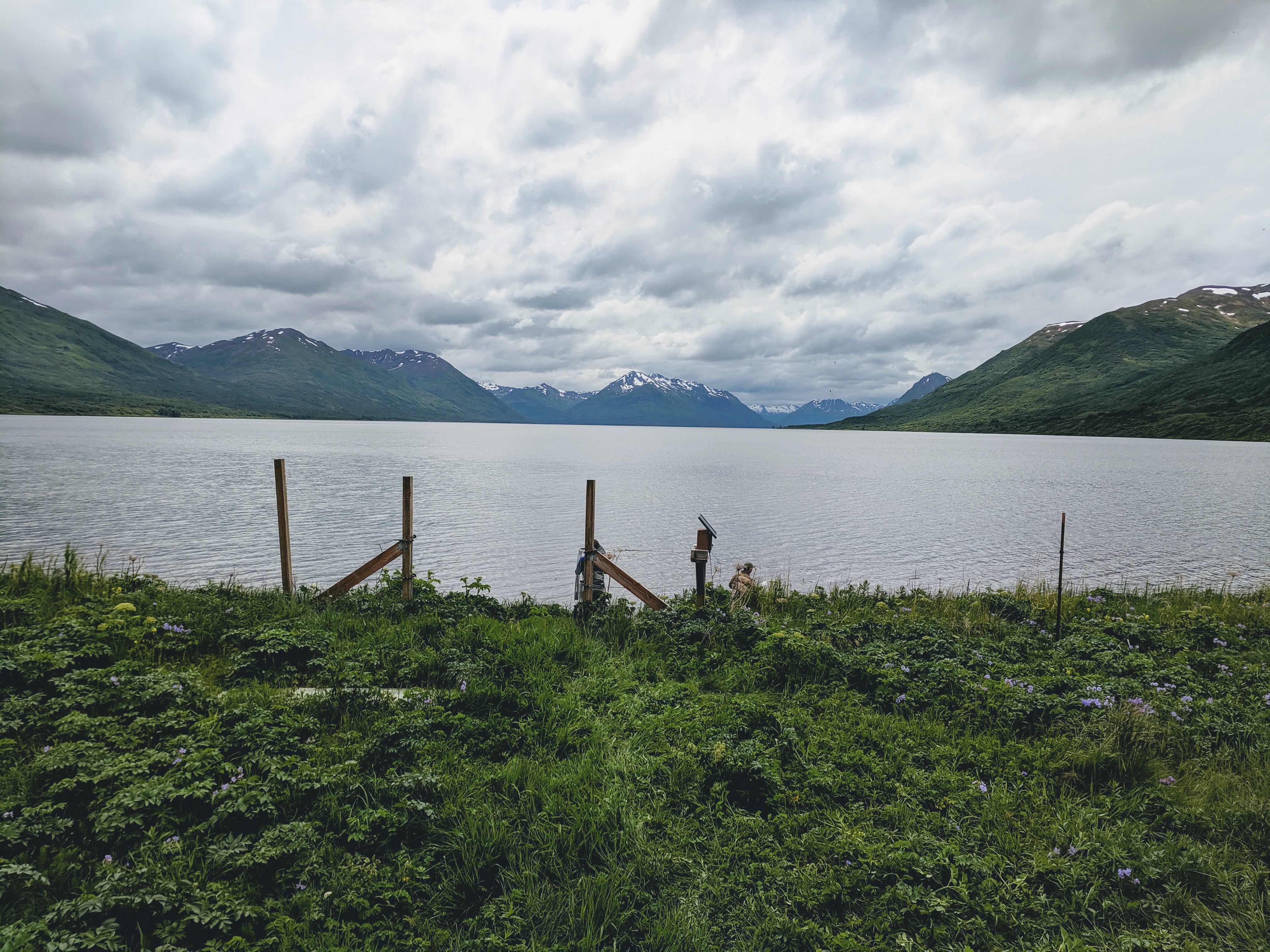
View of Karluk Lake from the cabin.
The most recent use of the site was in the 17th and 18th centuries, prior to Russian occupation of Kodiak, and consists of numerous multi-roomed houses. Alutiiq houses (or ciqlluat) in this time period often have thatched roofs, although we found that there were insulating roof sods on at least some of the side rooms at the house we excavated.
This was my first time working on an excavation on Kodiak, as the OHAHP has focused on survey thus far, and I am grateful to have learned from the vast experiences of archaeologists Patrick Saltonstall (check out his blog here), Molly Odell and Alex Painter from the Alutiiq Museum. Through the excavation, we learned that the house had been remodeled several times. There were two hearths in the main room, one clearly older than the other, and evidence in the back room of multiple uses, including as a sleeping room and a smoke house. There was a ton of charcoal and fire-cracked rock both in the house and in the associated trash pile outside the front door, so we are wondering how long the structure was used for living vs. smoking/preserving fish.
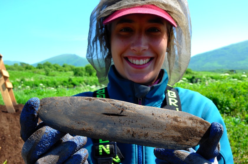
Patrick holding a ground slate point (PC: Patrick Saltonstall)
Labret found by the hearth (PC: Patrick Saltonstall)
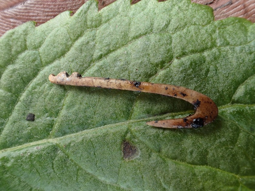
Fly-fishing hook (PC: Patrick Saltonstall)
Neck bone of a sea mammal (PC: Patrick Saltonstall)
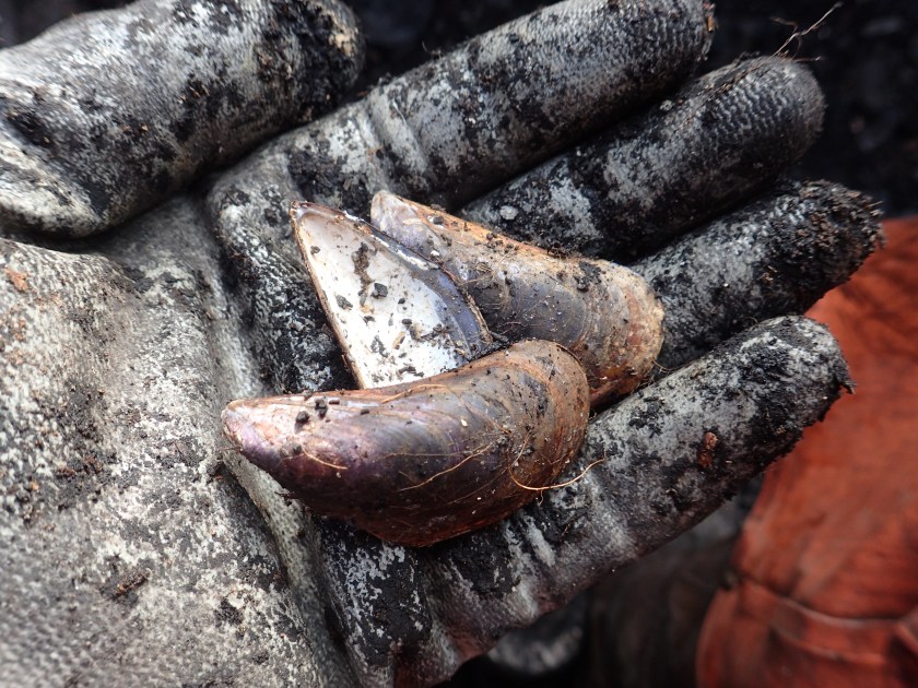
Blue mussel shells from the trash pile (PC: Patrick Saltonstall)
Tiny ground slate point
Complete ulu (PC: Patrick Saltonstall)
The team recovered some Sugpiaq-Alutiiq belongings and tools from the excavation, including a tiny fly-fishing hook (a new find for Kodiak!), ulus, ground slate points of various sizes and a labret! We also uncovered lots of animal bones and shells, which tells us about what Alutiiq people were eating. While we predominantly found fish bones, a resource that has and continues to draw people to the lake outlet, there were also shellfish and sea mammals, foods that only could have come from the coast. This indicates that Alutiiq ancestors were bringing coastal resources with them when they lived and fished at the lake and/or traded with other families that remained on the coast. Through the detailed analysis of the animal bones and shells, the research team hopes to learn more about what species were eaten and in which season the Karluk Lake village was occupied. This information helps archaeologists tell the story of how Alutiiq ancestors lived year to year and season to season, possibly moving between two or three houses or hunting/fishing camps within a year.
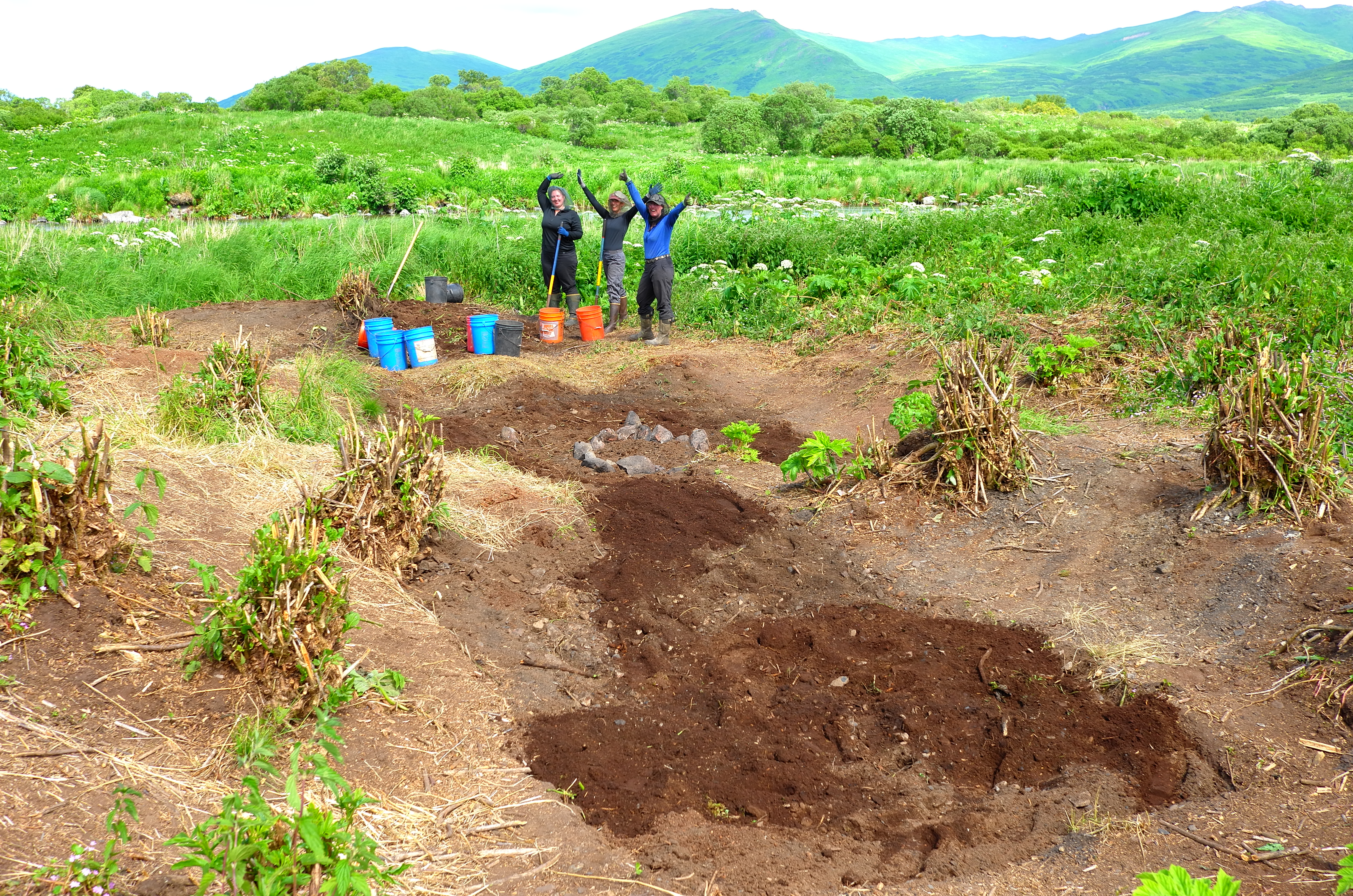
Alex, Hollis and Molly celebrating after backfilling the site. (PC: Patrick Saltonstall)
I learned so much about house excavation, site mapping and Sugpiaq-Alutiiq lifeways from this project and I am excited to take that knowledge with me when I start OHAHP’s 2019 fieldwork at Tanginak Anchorage in July!
As part of my grad school experience, I teach 5-credit writing seminars to undergraduate students. My students are all concurrently enrolled in anthropology courses, thus the purpose of my seminars is to help students write in the discipline. Although I have been “writing in the discipline” for the better part of a decade, prior to teaching, I never had to think about what it means to write in anthropology.
Now that I look back on three terms of instructing students, I still don’t think I have a distinct answer – anthropology writing is personal, scientific, ethnographic, (auto)biographic, global, local, theoretical, storytelling, public, scholarly, poetic, verbose, prosaic, mundane, significant, situated, etc. In short, anthropology writing is a lot of things, and I think that benefits our discipline by allowing for many kinds of expression and exploration.*
When it comes to introducing such a vast library to my students in anthropology writing seminars, I choose to build from the personal. I ask students to begin by considering their own identities and positionalities within the university and other spaces they inhabit, then build their awareness out from there to the experiences of their classmates and then out to other communities. By situating themselves first, students start to better understand themselves as knowers and as creators of knowledge, which gives them the tools and the confidence to make arguments, evaluate the arguments of others and get a sense of how arguments are built from both evidence and experience. Thus the sequence of assignments moves from a positionality statement to a student-designed ethnographic project to a more ‘traditional’ argumentative research paper and, finally, a reflective piece looking back at the journey.
Along the way, we cover other ‘writing’ topics like citations, paper organization, intros and conclusions, transitions, editing and revising, etc., but I hope that the biggest takeaway for my students is the confidence to join the conversation (of the academy, their professional careers, their communities) thoughtfully, respectfully and from a place of self-awareness.
*That being said, I recognize that not all forms of expression nor all forms of scholarship are equally valued in the academy, and it saddens me to see amazing public scholarship, community-building and creativity often go unremarked in academic circles.
After our successful pilot survey around Old Harbor, the Seattle-based team flew back to Kodiak for a week of museum work at both the Alutiiq and Baranov Museums. We had several goals: 1) accessioning the few artifacts from the survey into the Alutiiq Museum’s collection, 2) studying artifacts and field notes at the Alutiiq Museum and 3) looking at historic maps and documents at the Baranov Museum.
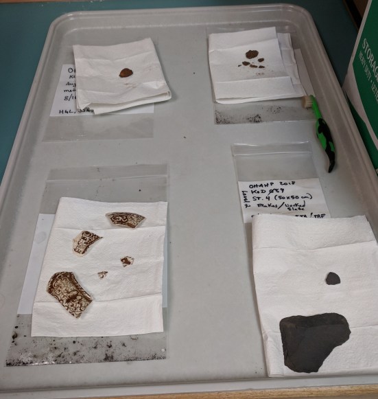
To accession the artifacts, Hope, Hollis and Larissa scanned all the field notes that our team members had taken during the survey, transferred photos to the museum’s collections manager, washed the artifacts and glued tiny paper catalog numbers to them. Thankfully, we only had 4 small bags of artifacts!
Artifacts from the 2018 pilot survey, post-cleaning. (PC: Hollis Miller)
Although Ben and Larissa had to catch a flight back to Seattle after just a couple days in Kodiak, Hollis and Hope stayed for another week to study museum collections. We started with the artifacts and notes from the University of Wisconsin’s Aleut/Konyag Project from the 1960s, which conducted excavations in Three Saints Bay, on southwestern Sitkalidak Island and at Kiavak (to the southwest of Three Saints Bay). These excavations laid some of the groundwork for archaeological interpretation of this region, however, the focus was not really on historic sites from the period of Russian occupation. These notes were helpful in learning the location and findings of previous excavations, including a small test done at the Three Saints Bay artel site, which we also surveyed this year. In addition to the Aleut/Konyag Project notes, we looked at collections from previous excavations at the Lighthouse Site and 1990s tests at Nunamiut, a cannery located in central Three Saints Bay.
Hollis Miller studying historic ceramics at the Alutiiq Museum. (PC: Hope Loiselle)
During our afternoon at the Baranov Museum, we looked at some replicas of historic maps of Kodiak. One of the things I was looking for was more documentation of the supposed Ukshivik settlement in Barling Bay, which we had tried and failed to locate during our pilot survey. I originally encountered Ukshivik on a map from the Kodiak Island Borough, which listed the settlement as abandoned. A circa 1850 map in Sonja Luehrmann’s book Alutiiq Villages under Russian and U.S. Rule (2008) also has an odinochka (or small seasonal labor camp) in the same approximate location; however, when I asked a few folks from Old Harbor about it, they had not heard of such a site. It is a bit of a mystery!
Caption from the 1849 map of Kodiak, courtesy of the Baranov Museum.
At the Baranov Museum, I looked at a map drawn by Captain Illarion Arkhimandritov in 1849 and saw that there was a settlement in Barling Bay called Ukshivikak (approximated from pronunciation of Russian text) – not too different from Ukshivik. I cannot publicly post pictures of the map, but you can see some of the areas detailed in the caption above. So, these findings beg the question – why didn’t we find Ukshivik? The maps in Luehrmann’s book and at the museum were too zoomed out to determine the exact location of the settlement, so it is possible that the large site (KOD-551) we found to the north of Ukshivik’s expected location is the one mentioned on these maps. It is also possible that the settlement mapped in 1849 is closer to the mouth of the bay where other historic sites are known to be. We did not investigate those sites during our survey as they have been significantly eroded and we did not expect them to yield much data. I look forward to searching for other maps and reading ethnohistoric accounts of the region to see if there are more clues about the Ukshivik settlement and its residents!
On our final day of fieldwork, the team headed west from Old Harbor to Three Saints Bay, which is one bay over from Barling Bay. Three Saints Bay is perhaps infamous in the history of Kodiak as the place where Grigorii Shelikhov built the first permanent Russian settlement in Alaska after orchestrating a brutal massacre of Sugpiaq/Alutiiq people at Refuge Rock (known in the Native language as Awa’uq) in 1784. Russian construction in Three Saints consisted of a main fort (or krepost) and a separate settlement or work camp for Sugpiaq/Alutiiq hostages taken after the massacre. The krepost served as the administrative center of Russia’s Alaskan ventures until it was damaged following earthquakes and the administrative center moved to St. Paul Harbor (modern day Kodiak city) in 1792. What remained was the Sugpiaq/Alutiiq work camp or artel, which continued to be used for at least a couple more decades. It was this site that our team was looking for during our survey of Three Saints Bay.
Remains of a hunting/fishing cabin in Three Saints Bay. The owner of the cabin chose to dismantle it when they sold the land about 10 years ago. (PC: Ben Fitzhugh)
Since we did not know the exact location of the site, we had to investigate a large swath of the shoreline, watching for eroding artifacts and house pits or other anomalous depressions or ridges as we walked. The first evidence of human occupation we found were the remains of a cabin, which had collapsed and likely been burned no more than a decade before. It was really cool to see an archaeological site in the making with this cabin, as you could still easily discern the structure and numerous artifacts on the surface. I wonder what the cabin site would look like in another 50 years? 100 years?
Wood and metal artifacts from the cabin in Three Saints bay. (PC: Ben Fitzhugh)
From the cabin, we continued up the coast, crossing a wide stream into a forested area, where we found a few depressions that looked like small house pits. It would be anomalous for Sugpiaq/Alutiiq people to build houses in such a low, wet, forested area, so we surmised that these Sugpiaq/Alutiiq houses were not placed here by choice. (Later research at the Alutiiq Museum suggests that these houses were part of an American period settlement associated with a cannery.) Nevertheless, the site did not match the description of the one we were looking for, so we continued searching and, as we were heading back to the boat, found a large midden deposit eroding onto the beach. The midden contained preserved shell and bone, in addition to a couple slate artifacts. We had found the artel site!
Bone and shell eroding from the midden at the Three Saints Bay artel site. (PC: Hope Loiselle)
Closer examination of the eroding midden face and the surface above it suggest that the site has been disturbed by both bear and human digging. We know that a team of University of Wisconsin archaeologists did some testing at the site in early 1960s, but there were more pits in the site than they reported digging. Despite the disturbance and lack of clear house pits, the midden is rich and extends for at least 30 meters along the shoreline – making this a potential site for future sampling or excavation. The site is part of an important story of the early (often violent and cruel) interactions between Sugpiat/Alutiit and Russian fur traders and is also the beginning of the community of Old Harbor, which was the name given to this artel site following the move of the administrative center to St. Paul Harbor.
Panoramic view of the eroding face of the artel site midden in Three Saints Bay. (PC: Ben Fitzhugh)
The question remaining about the site is whether or not we would be able to make sense of any artifacts we may find here, given the disturbed nature of the site (similar to considerations that we need to make about the Lighthouse site). Hollis and Ben are currently thinking through the next steps for the project, including future excavations, as they assemble an official report on the 2018 survey.
On a misty morning, we boated out to Kiliuda Bay, located to the northeast of Old Harbor. There are numerous archaeological sites in Kiliuda Bay, but we were just interested in one – a site that was occupied from before Russian contact through the late 1830s. In the literature it is usually referred to as simply ‘the Kiliuda site’. This site was visited by Russian explorer Urey Lisiansky in 1805 and is mentioned in Church records through the 1830s when the village was depopulated following a smallpox epidemic. After this epidemic, the Russian American Company purposely consolidated the remaining Kodiak Archipelago population into seven villages, leaving many sites, such as Kiliuda, abandoned. These seven consolidated villages were the forerunners of the modern towns and villages on Kodiak today.
Location of Kiliuda Bay relative to Old Harbor.
When we got to the Kiliuda site, the whole area was shrouded in a thick fog, but thankfully it soon lifted so that we could take in the beautiful surroundings! The site has a great vantage point to see both deeper into the bay and out to Sitkalidak Island – I can see why people would want to live here! There is also a calm cove around the corner from the site, which would be useful for coming and going by boat (in fact, we moored our boat there).
Hollis Miller standing on the high point of the site, which continues along the beach behind her. (PC: Ben Fitzhugh)
View from the Kiliuda site, Sitkalidak Island in the background. (PC: Hollis Miller)
At this site, we opted not to probe the subsurface with the auger or soil probe because it was quite obvious from pedestrian survey that the site was well preserved. We found several large and deep house pits in a line along the shore in addition to an extensive midden deposit. A distinguishing feature of this site was the plethora of sea mammal and fish bones right along the beach. Some of these likely eroded out of the archaeological site, but others were probably more recent and naturally deposited on the beach by waves. Having such good preservation on the surface is an indicator that more bones will be preserved in the midden itself. By studying the bones of animals that people left behind, we can learn a lot about their diet, food preparation and skin processing – and how those might have changed during the new colonial situation.
Fish vertebra found eroding out of the Kiliuda site. (PC: Hollis Miller)
We recorded the locations of the houses and middens and then took drone footage of the site, which should help us identify more features on the surface. This site is a good candidate for excavation due to its preservation and age. It could help tell the story of communities that were already in existence at the time of Russian contact and how they responded to newly imposed demands while maintaining their original settlement location.
Sea mammal humerus (likely from a seal) found on the beach at the Kiliuda site. (PC: Hollis Miller)